Objectives of the monitoring
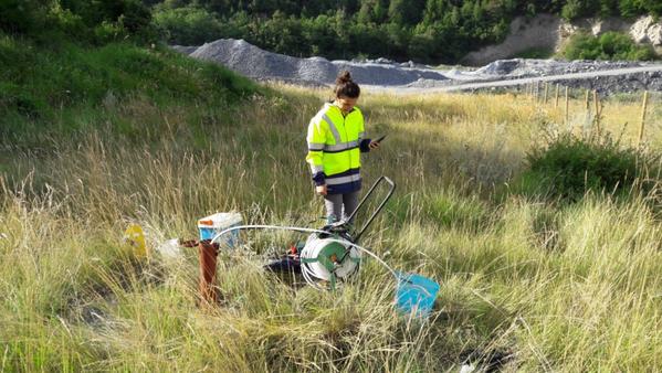
Groundwater accompanying rivers is generally used to supply drinking water networks, so preserving its quality is a major concern. Soil naturally acts as a filter for infiltrating rainwater and, by retaining certain elements, provides natural purification; however, this does not always prevent surface pollution from eventually reaching groundwater after a certain delay. For TELT, groundwater quality monitoring is used in particular to confirm the proper functioning of stormwater management systems on its construction sites, including infiltration basins. It is carried out through physico-chemical analysis of water samples collected from piezometers—short boreholes fitted with tubes—located in the alluvial aquifer of the Arc River.
The key indicator
Hydrocarbon concentration
Twenty-one physico-chemical parameters are analysed as part of this monitoring, providing multiple indicators of groundwater quality. Among these parameters, six relate to hydrocarbons and nine to heavy metals.
A set of measures is implemented on construction sites to limit the risk of events (for example, accidental hydrocarbon leaks) that could cause soil pollution, and to reduce and control any resulting impacts. These include, for instance, parking machinery on impermeable surfaces equipped with hydrocarbon separators, storing hazardous products in containment areas under cover, and providing absorbent or containment materials for hydrocarbons at refuelling points, among others.
Partners
The consultancy firm commissioned by TELT: Géotec
Characteristics of the monitoring
Concentration for each of the 21 monitored physico-chemical parameters Water level
An alert threshold table provides, for each parameter, a reference value against which the measurement results are compared.
Discover…
Groundwater–river interactions
The water flowing in riverbeds represents only the visible part of the fluxes associated with watercourses: like the submerged part of an iceberg, a watercourse is also associated with a much larger flow that moves more slowly beneath the surface of the rivers. These are alluvial aquifers. The relationship between a river and its associated aquifer can take two different forms: either the river feeds the aquifer, or the aquifer is drained by the river. The direction of migration of any pollutants from the riverbanks is influenced by this relationship.
At each of TELT’s construction sites, piezometers reaching the aquifer and used for water sampling are located both upstream, downstream, and within the sites themselves. This makes it possible to better interpret the origin of any disturbances that may be observed during monitoring.